Azure Maps consists of a set of geospatial REST APIs and a JavaScript web map control. Some of the services (including the data service) are in preview.
What caught my particular interest was a Data Service which allows you to bring your own data in GeoJSON format, upload it, and then perform spatial queries on the data.
After a quick play with the service, there are some interesting things to note:
-
The API services are secured with an API key (similar to Azure Storage) which you include as part of the URL to any call to the service. You can also use an OAuth flow (which I haven’t tried). One thing that bothers me here is that there isn’t (as far as I can tell) a public key / private key. If you embed an Azure Map control on a web page you include your subscription key to enable it. However, anyone reading the source can then take that key and download/update/delete all of your data. They have full read/write permission to all the data in your Azure Map service.
-
The API services are CORS enabled, so you can upload/download and perform queries directly from the browser. Nice.
-
The Data API allows you to upload a data ‘set’ at a time. You can update a set, but you replace the entire set. You cannot update/delete a single feature. This means it’s well suited to large ‘static’ sets of data, and not dynamic data feeds.
-
The Data API allows you to download the data set as a single JSON file, but you cannot page or download a subsection using a bounding box (or similar). The Spatial APIs do allow you to query the data by finding the features nearest a point, or within a buffer, but not a simple bounding box.
-
The Spatial API only returns the value of the
geometryIdproperty of the GeoJSON feature, and doesn’t give you the feature object itself. This means you need to include ageometryIdproperty on your source data if you want to use it with the Spatial API. It also means you need to download your entire dataset in advance, or have it stored elsewhere, so you can look it up bygeometryId. -
The Spatial API allows you to make queries such as ‘find the nearest point’ on data that you post up with the call. You can also calculate the distance between two given points. These seem like calls that should be provided by a library rather than an API.
-
When I uploaded invalid data (my bad) I got an error message like this, which didn’t help me to identify the cause of the problem ` Upload request failed.\nYour data has been removed as we encountered the following problems with it: System.Threading.Tasks.Task’1[System.String[]] `
-
Although I haven’t explored much of functionality, the Azure Maps Web Control does look promising. Although I think it’s unfortunate that you need a subscription to use it. It should be released as a free, and open source library.
My Own Admin Portal
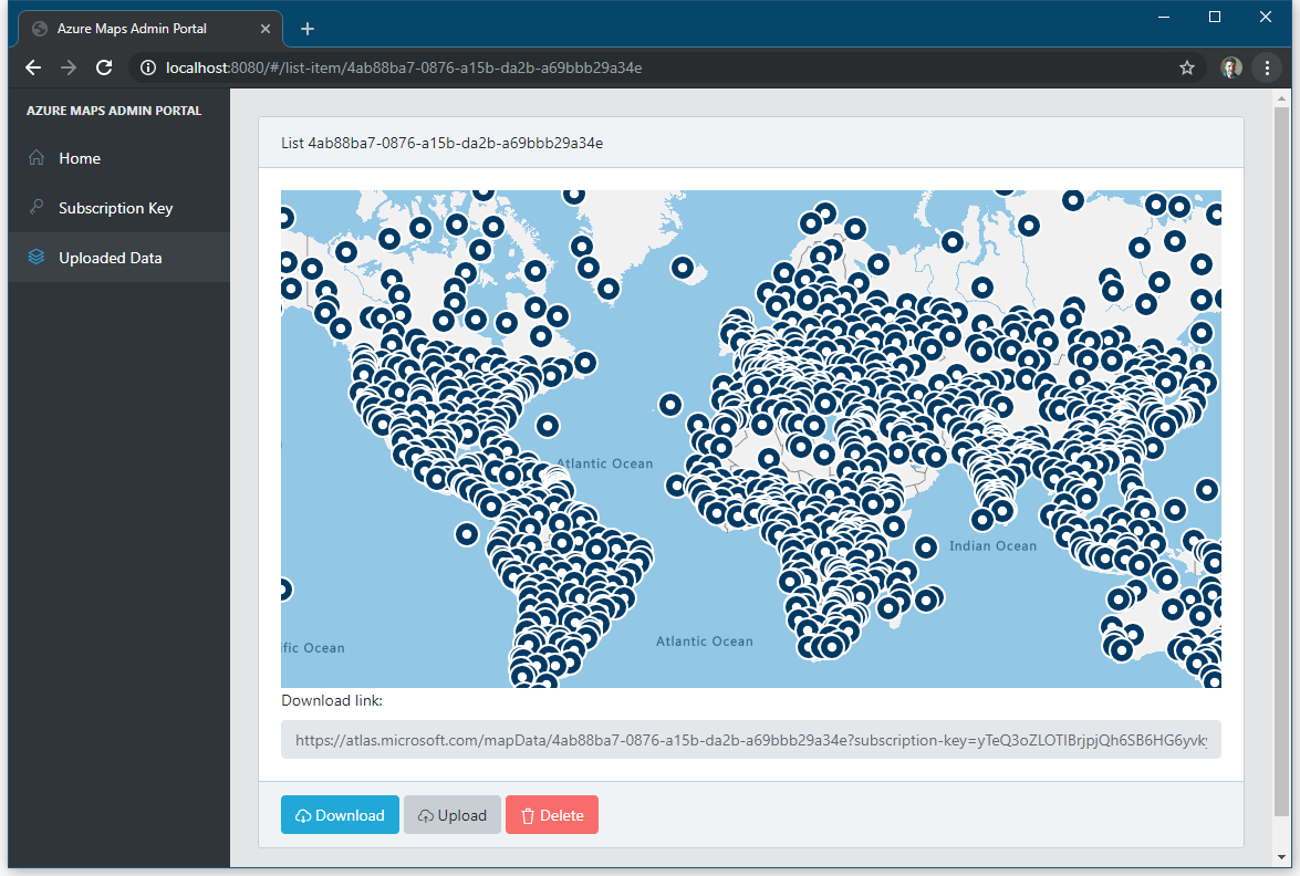
There is no management user interface to view/upload/delete your data sets, so I created one (for fun): Azure Maps Admin Portal.
It’s open source, and you can contribute to it on GitHub.
Conclusion
The Azure Maps Data Service is in preview, and we can’t expect a polished product. However there are a number of problems with the current offering, which need to be addressed before it could be used for real world problems.
I’m keeping an eye on it.